Date: 8/8/22
Miles: 16.1
Total Miles: 41.1
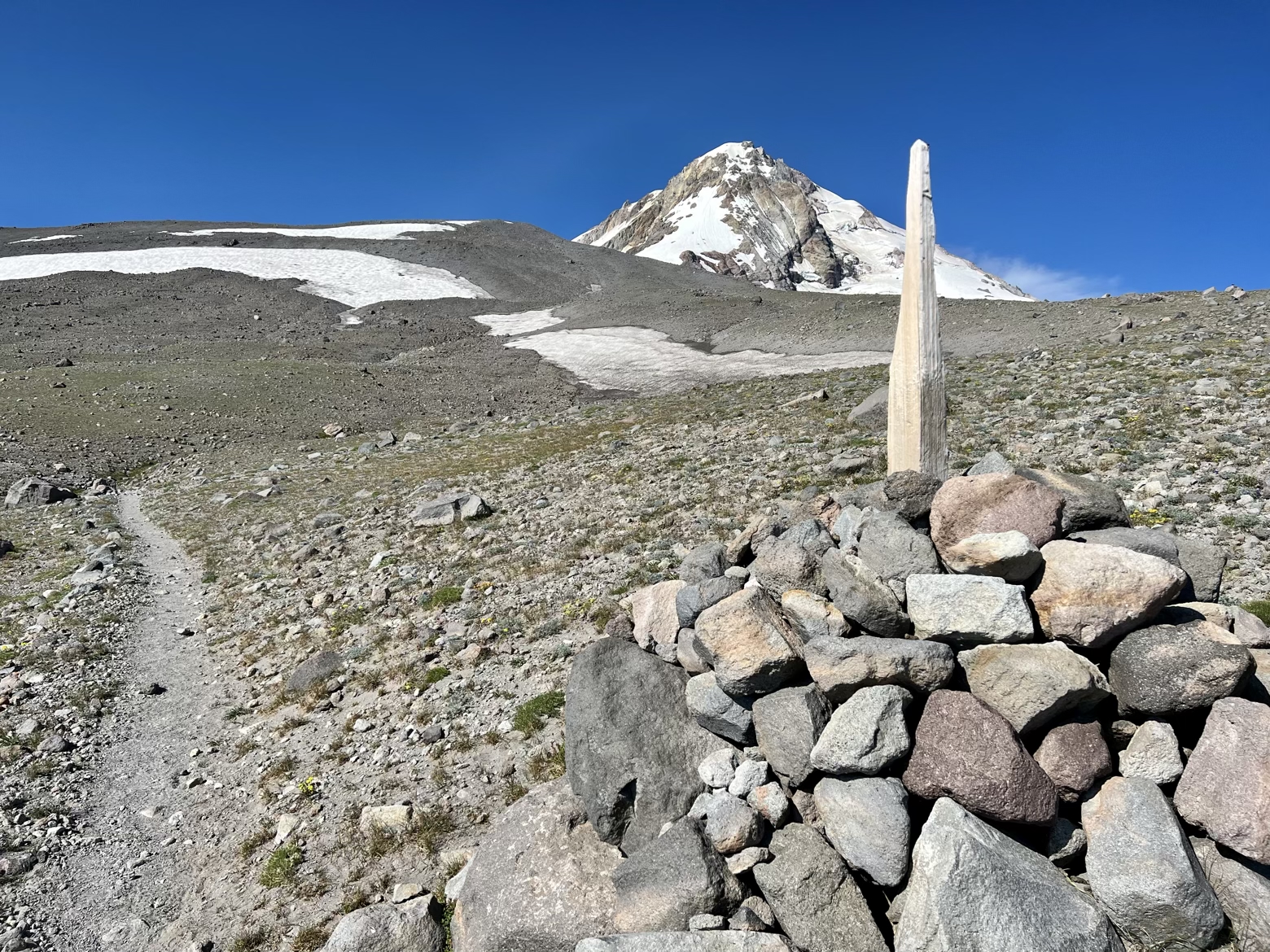
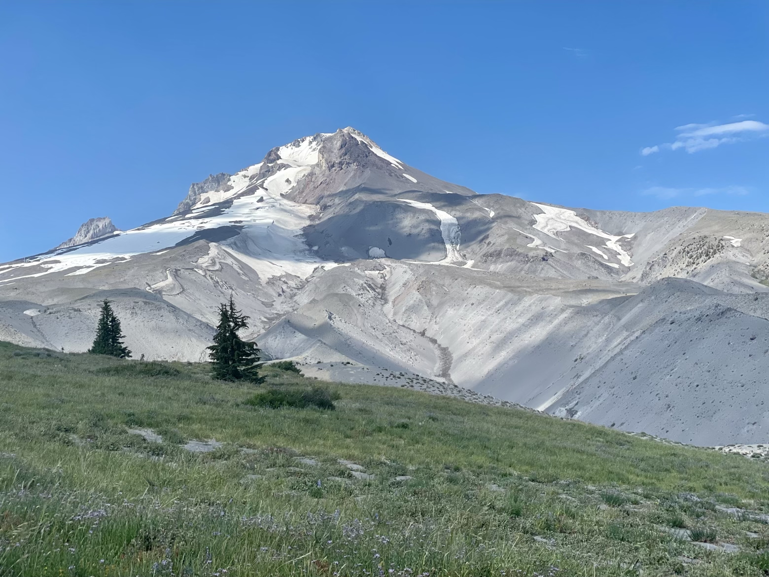
11,249 feet. Not ninety minutes ago, it had basked in the first rays of morning light before anywhere else, the sun spilling down from Mount Hood's summit until it wakened the glaciers and, eventually, the forests below. Towering some 6,000 feet into the dizzyingly empty space above our heads, it's a height difference that human minds aren't fully equipped to understand. Judging with only your eyes, it might as well be 60,000 feet.
It was then we realized that we had a very recent barometer of the climb we were now sizing up from the shadows beside Compass Creek. Impossible as it may have seemed, the summit of Mount Hood was no larger a climb from where we stood than the one on the first day of the John Muir Trail: the climb out of the cathedral of Yosemite Valley and up into the High Sierra. All 6,000 feet of it.
Everything in open space seems designed to deceive. Distances expand and contract, fooling our eyes. Sounds amplify around one bend of trail, making harmless streams sound like raging torrents, and then disappear entirely around the next. A mountain the size of Mount Hood looks as though it surely must take weeks to walk around, and yet there we were on the morning of our second full day already wondering how hot our car would be when we arrived back to it later that same afternoon.
As the shadows peeled back along the first miles of the day, we could already feel the heat that was in store. Early rays of sunlight with seemingly angry intentions that knew all too well that before long, we'd have nowhere to hide from their unrelenting wrath.
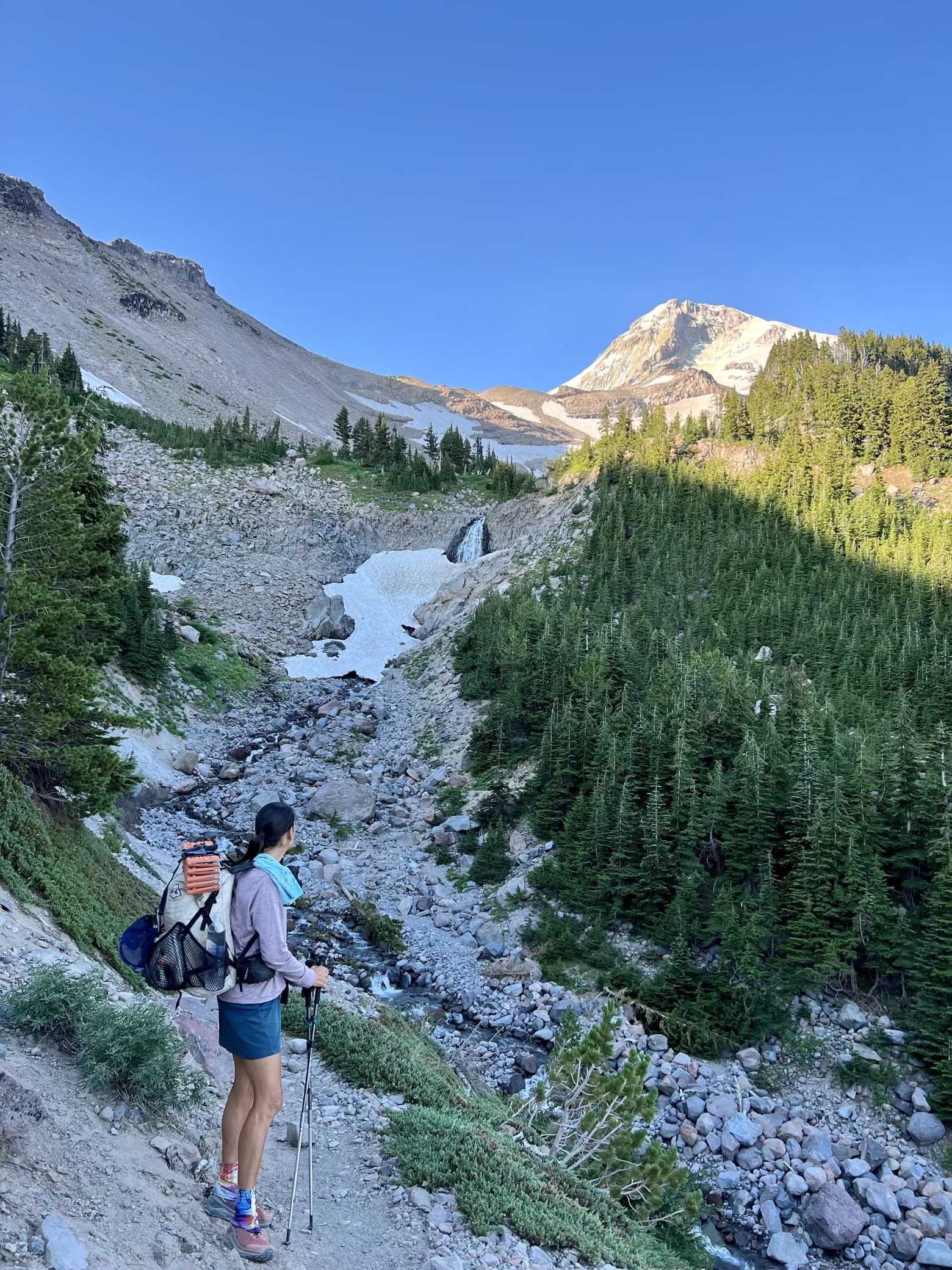
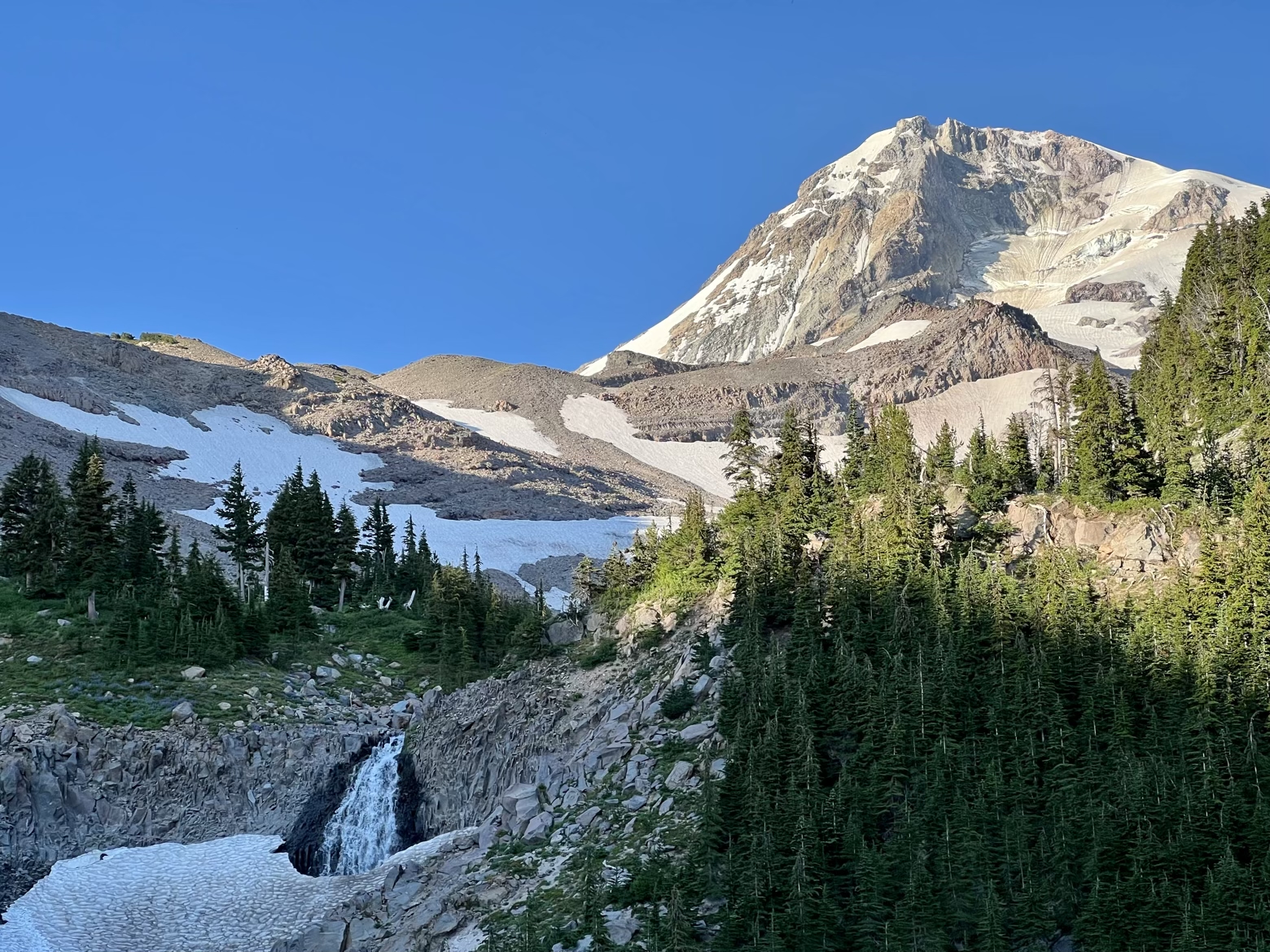
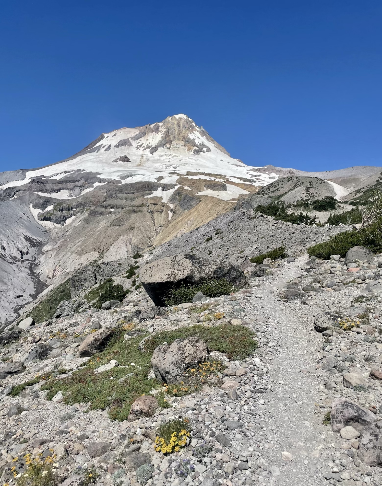
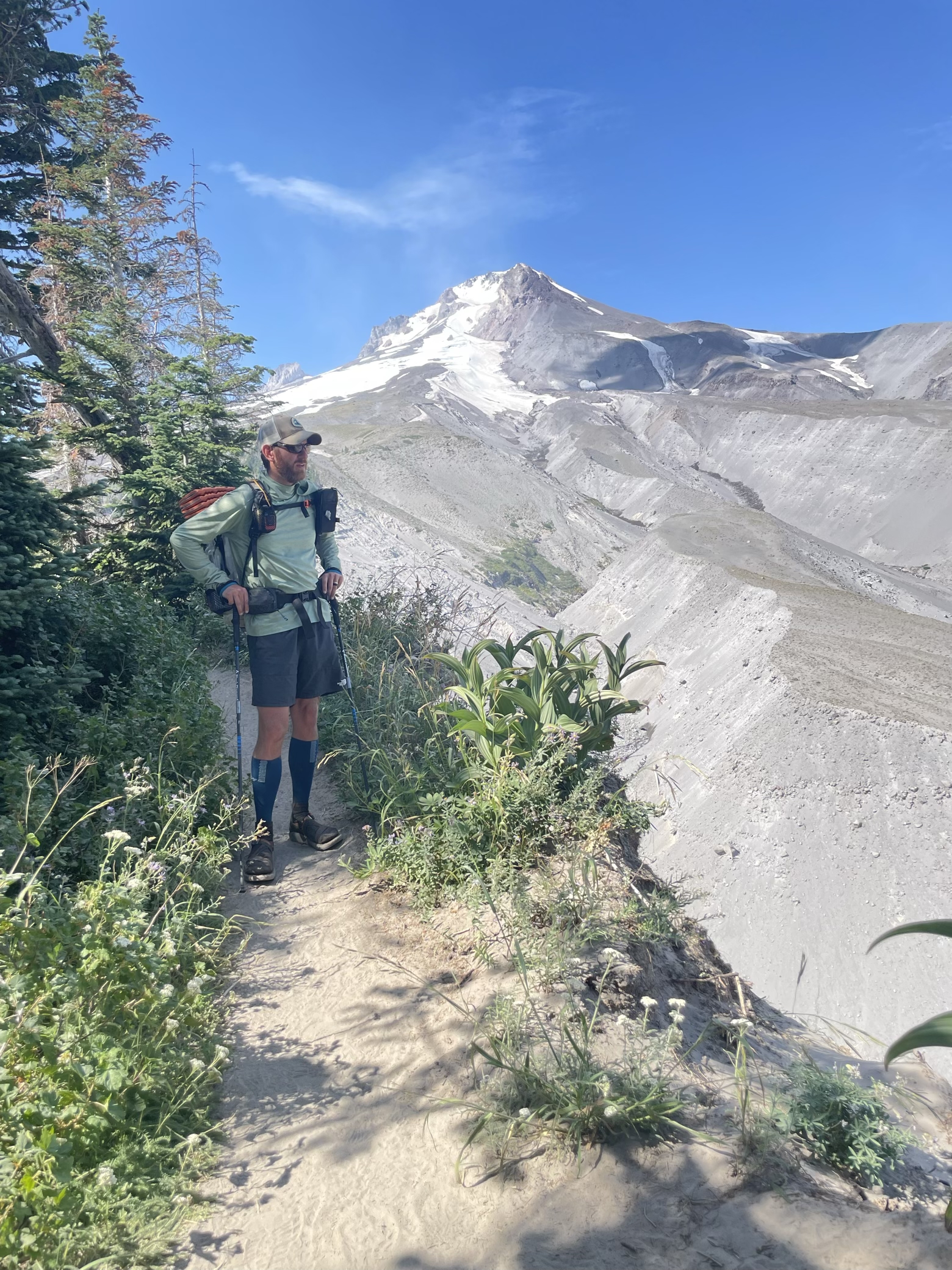
Down we went to a crossing that has confounded thru-hikers of the Timberline Trail as much for its precarious banks of sand and loose stone as for its perilously swift water: the Eliot Branch. Bracketed by massive lateral moraines, the Eliot Branch continuously scours its silty waters against every boulder in its path, ever deepening its drainage in a topography that seems hellbent on destroying any trail that could be built across it.
Case in point, the trail on either side leads not to any particular place especially suited for crossing the creek itself, but rather dissolves into nothingness, the result of banks so unstable they transform under the weight of a single footstep. Think: clambering up or down a steep sand dune, except instead of mere grains of sand frustratingly shifting beneath you, this sand dune has massive boulders shifting along with the sand.
By the time we reached the barely 20-foot crossing, it was clear that maintaining dry feet would be out of the question. Thanks to the icy glacier it drains high above, it took only seconds of fording the gray-brown water to have an ice cream headache in my feet. Standing on the opposite side, we looked back to wonder what this little maelstrom must be like in the peak of spring runoff. One guess? Terrifying.
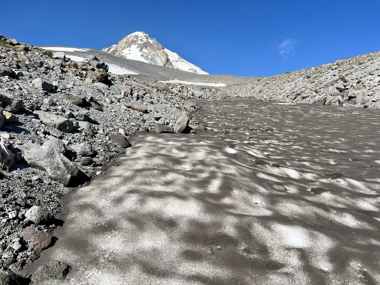
Climbing up a string of switchbacks, the Eliot Branch shrank smaller below us and I sank into daydream about the transience of nearly everything we've seen along the Timberline Trail thus far. Snows pile and melt, glaciers advance and retreat, rivers swell and recede, rocks tumble, sandy moraines shift, and even the trail itself disappears under the weight of the erosive forces that surround it. No matter how slow or how fast, everything here seems to be in constant motion.
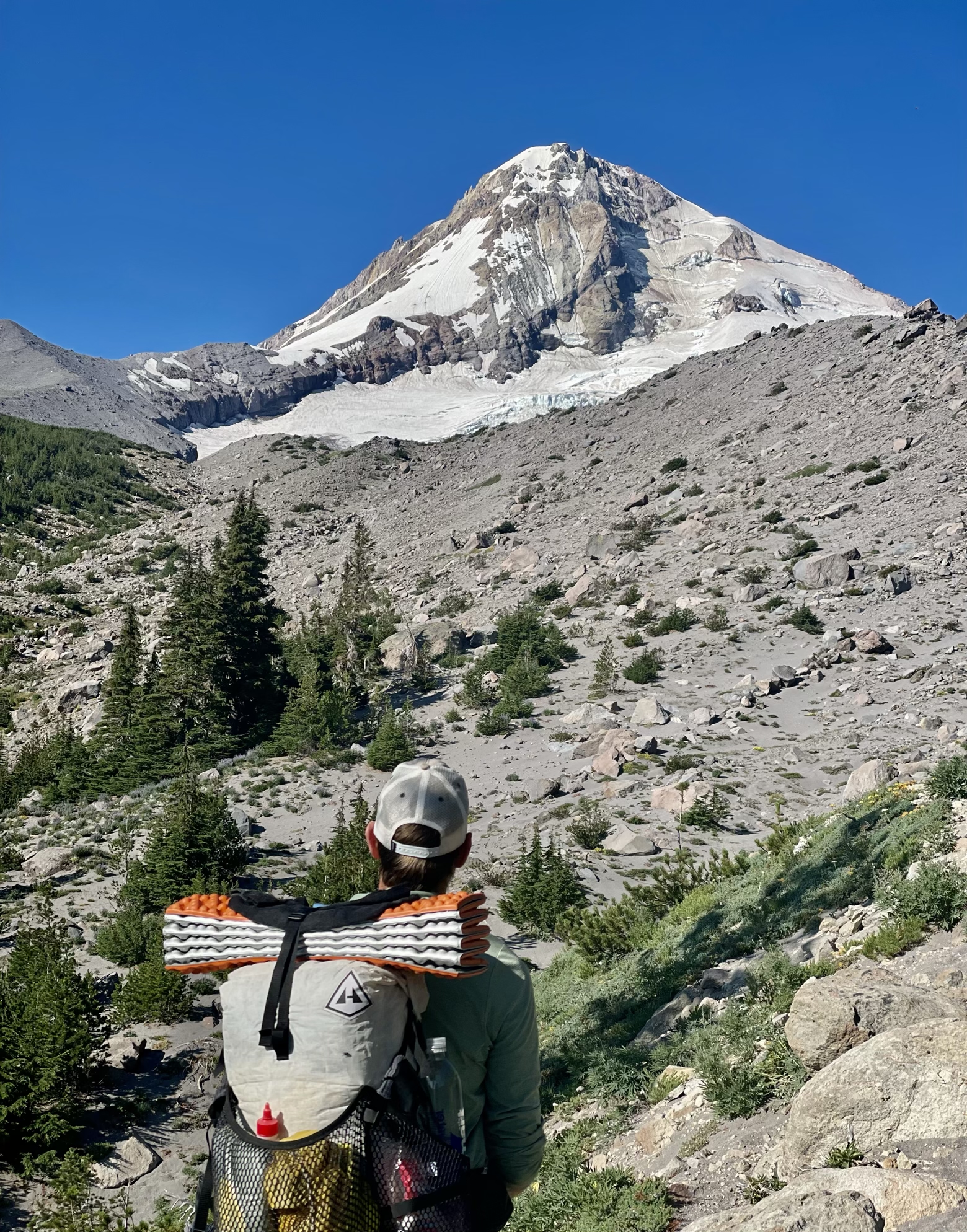
The forest at last fell away and all that was left was the barren expanse of Mount Hood's eastern aspect, with an alternating mix of rock and the vestiges of last winter's snow, clinging as best they could to the cool of their shallow drainages beneath the heat of an unobstructed sun.
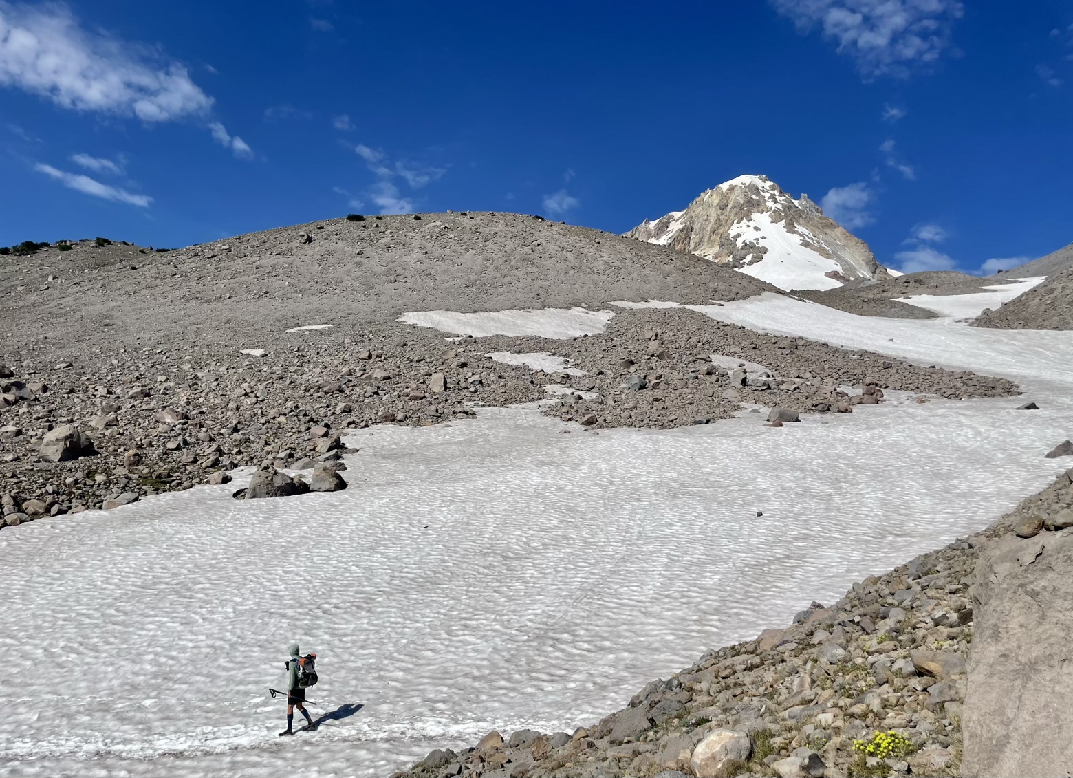
Passing the trail's high point of little more than 7,300 feet, we started the now familiar pattern of descending to the next glacial runoff crossing, which would be followed by yet another climb back up. It's a cycle that's especially characteristic of the trails that encircle the nearby and similarly massive volcanoes of the Cascade Range. Down to a raging river, up to another stunning view, rinse and repeat.
With only a handful of miles left, it had us thinking about the Timberline's similarities to its nearby cousins-namely, the Loowit Trail around Mount Saint Helens and the Wonderland Trail around Mount Rainier. Three trails. Three volcanoes. The Appalachian, Pacific Crest, and Continental Divide Trails may already lay claim to the title of "Triple Crown," but these three humble trails around the mighty volcanoes on either side of the Columbia River seemed deserving of their own nickname.
On we went, brainstorming the possibilities until Ace finally landed on the answer: the Triple Lava Loop.
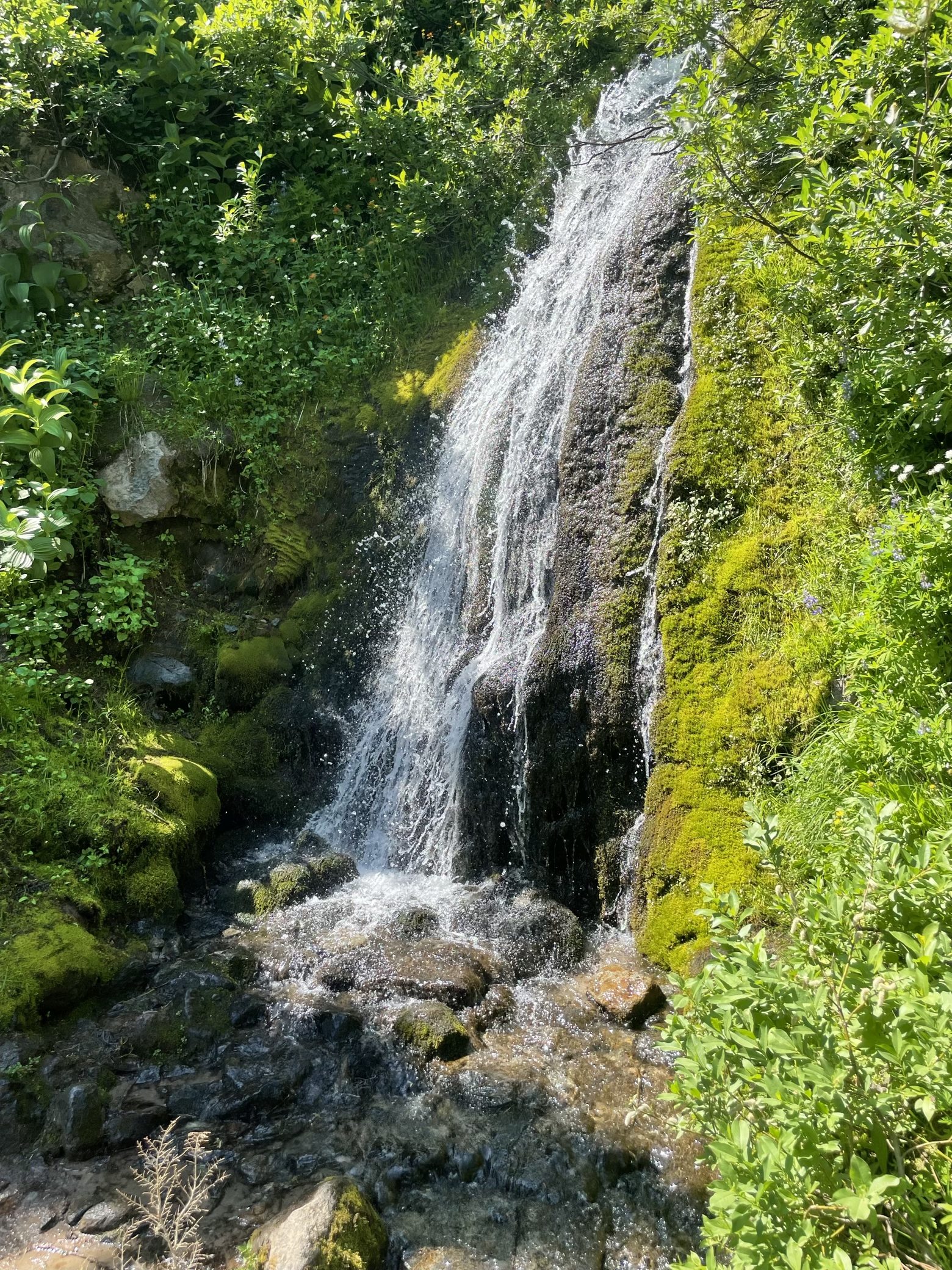
As we descended to the next drainage, the unbroken sea of stone and snow, of grays and whites finally yielded to the deep green forest and its merciful shade. The tumultuous, cloudy flow of the glaciers was also interrupted by the crystal clear waters of idyllic streams and tiny waterfalls, their surroundings painted in a color of green I hardly could believe existed outside the tropics.
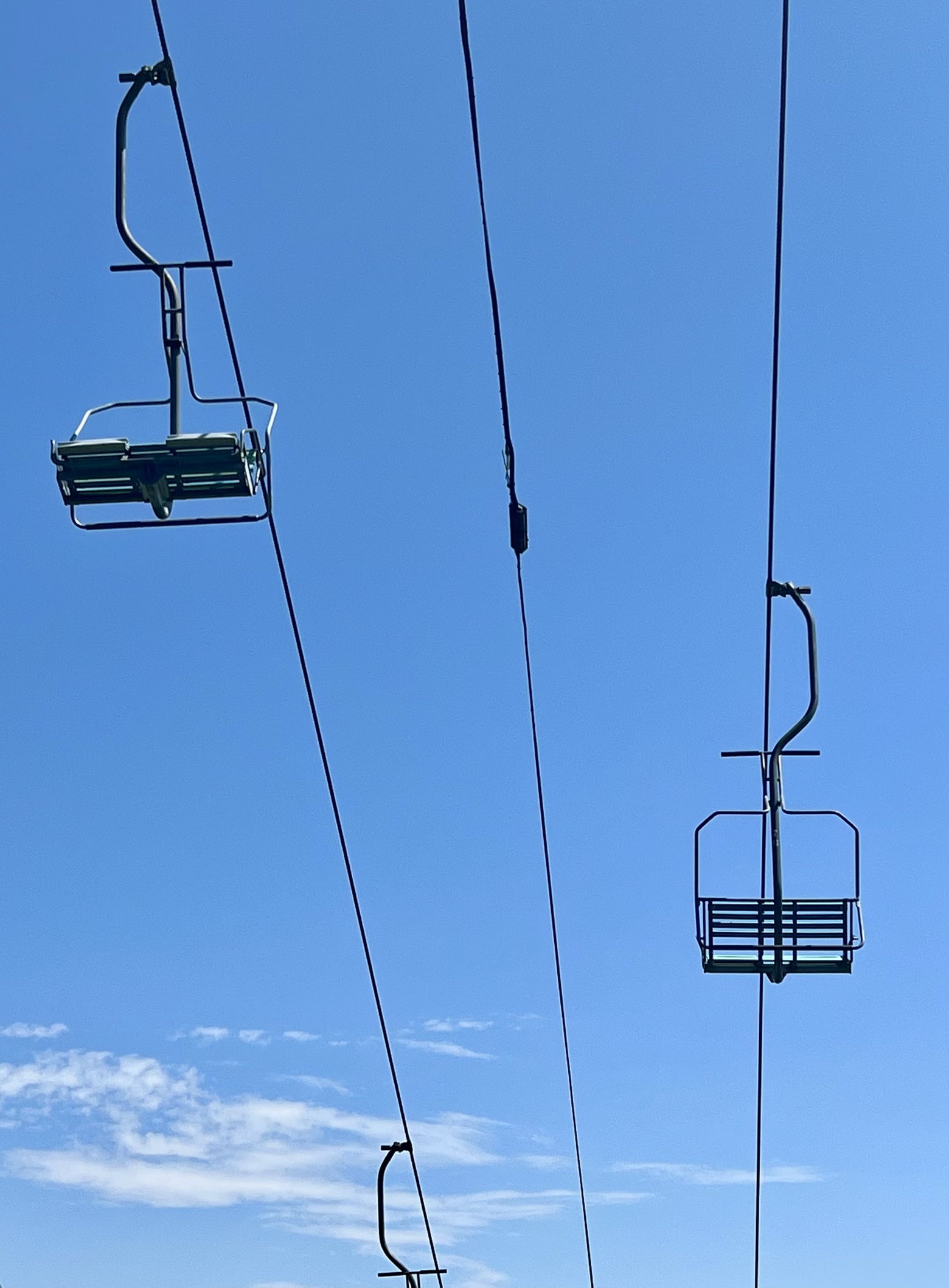
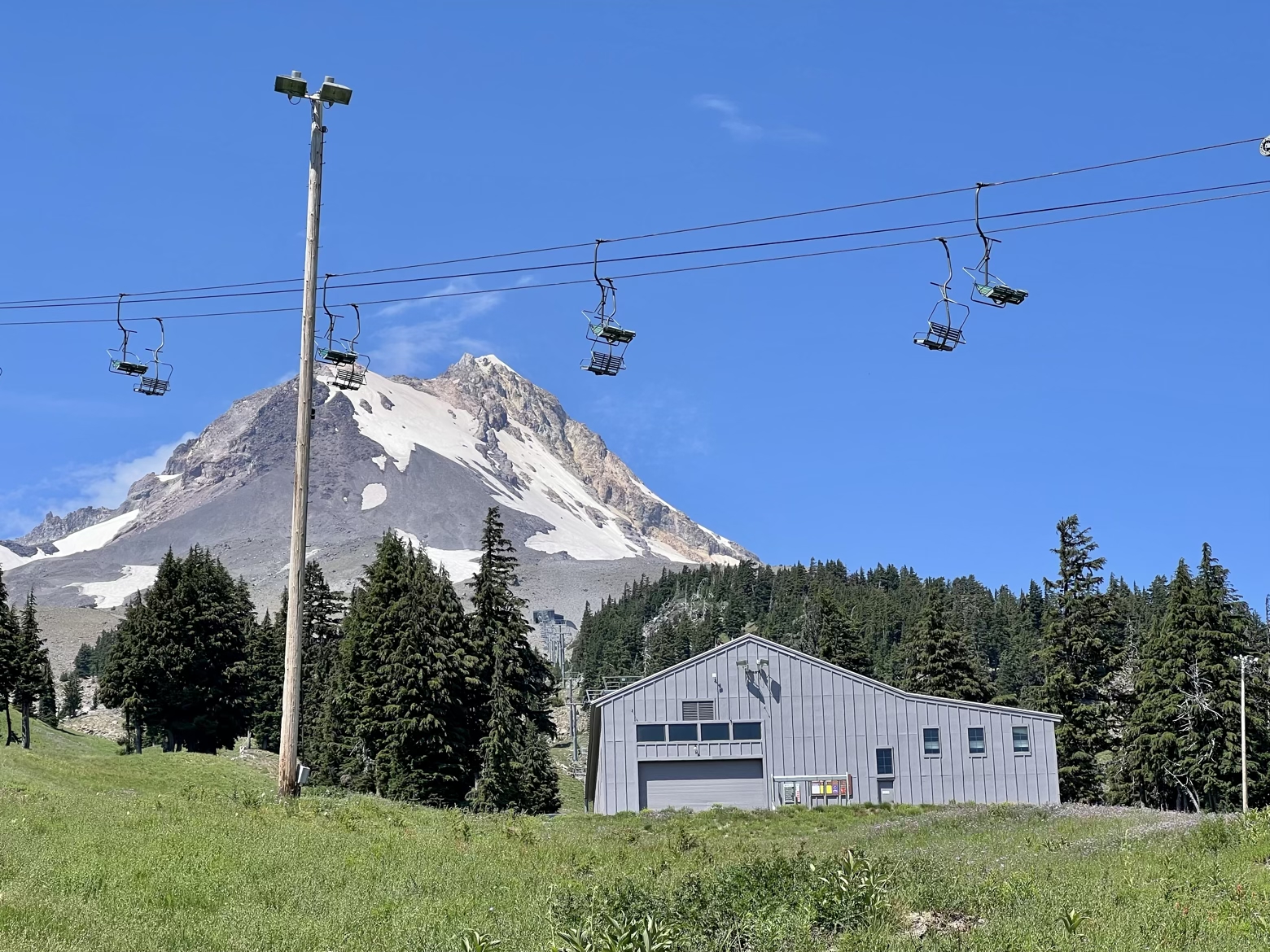
Over one rise, the foreign shape of ski lifts appeared overhead, collecting dust in anticipation of the winter snows that will bring them back to life. Beneath them, the trail meandered across wide open meadows brimming with wildflowers that apparently serve quite nicely as natural ski runs during the winter months. And looking back, there was Mount Hood, lording over it all.
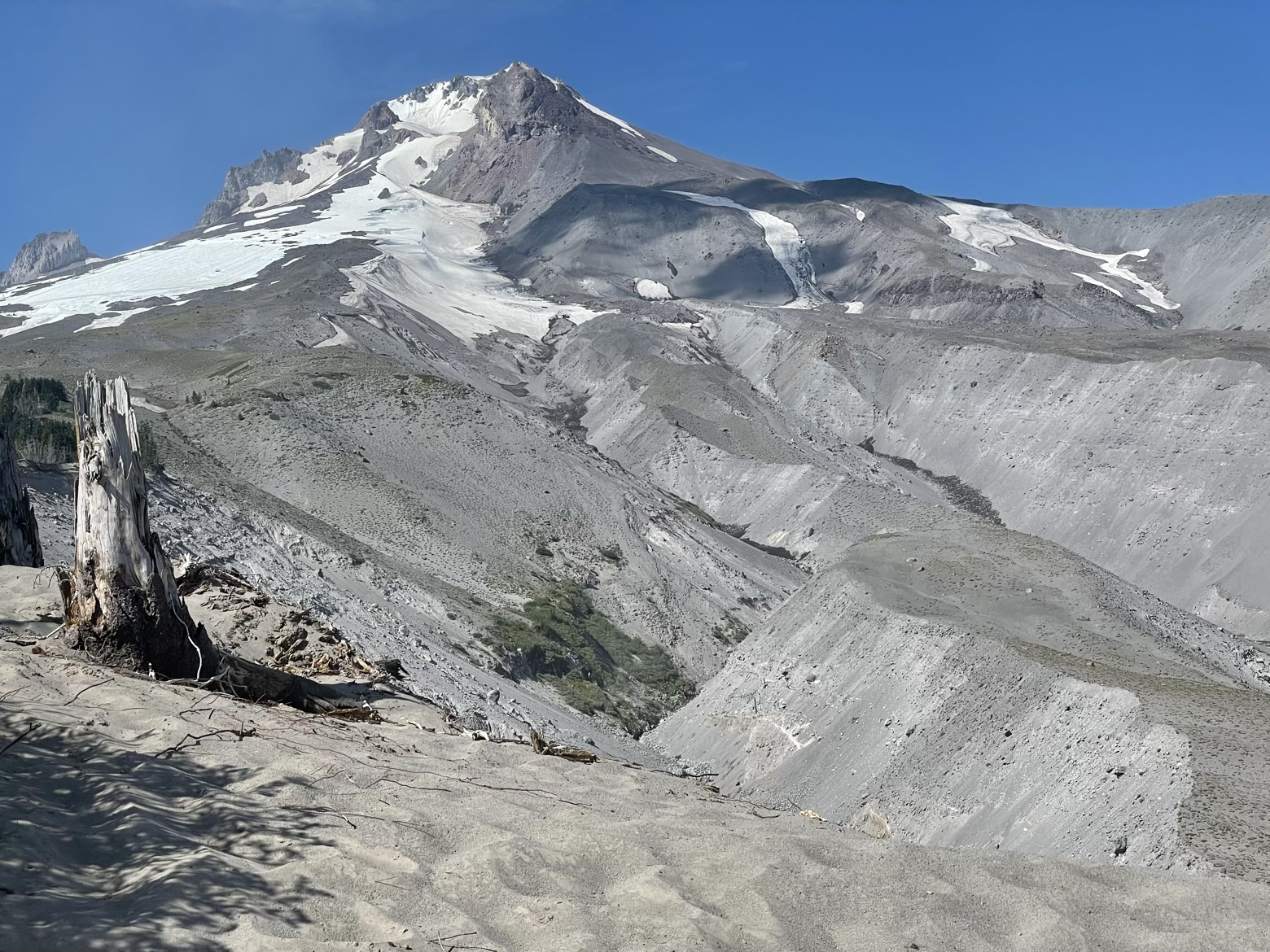
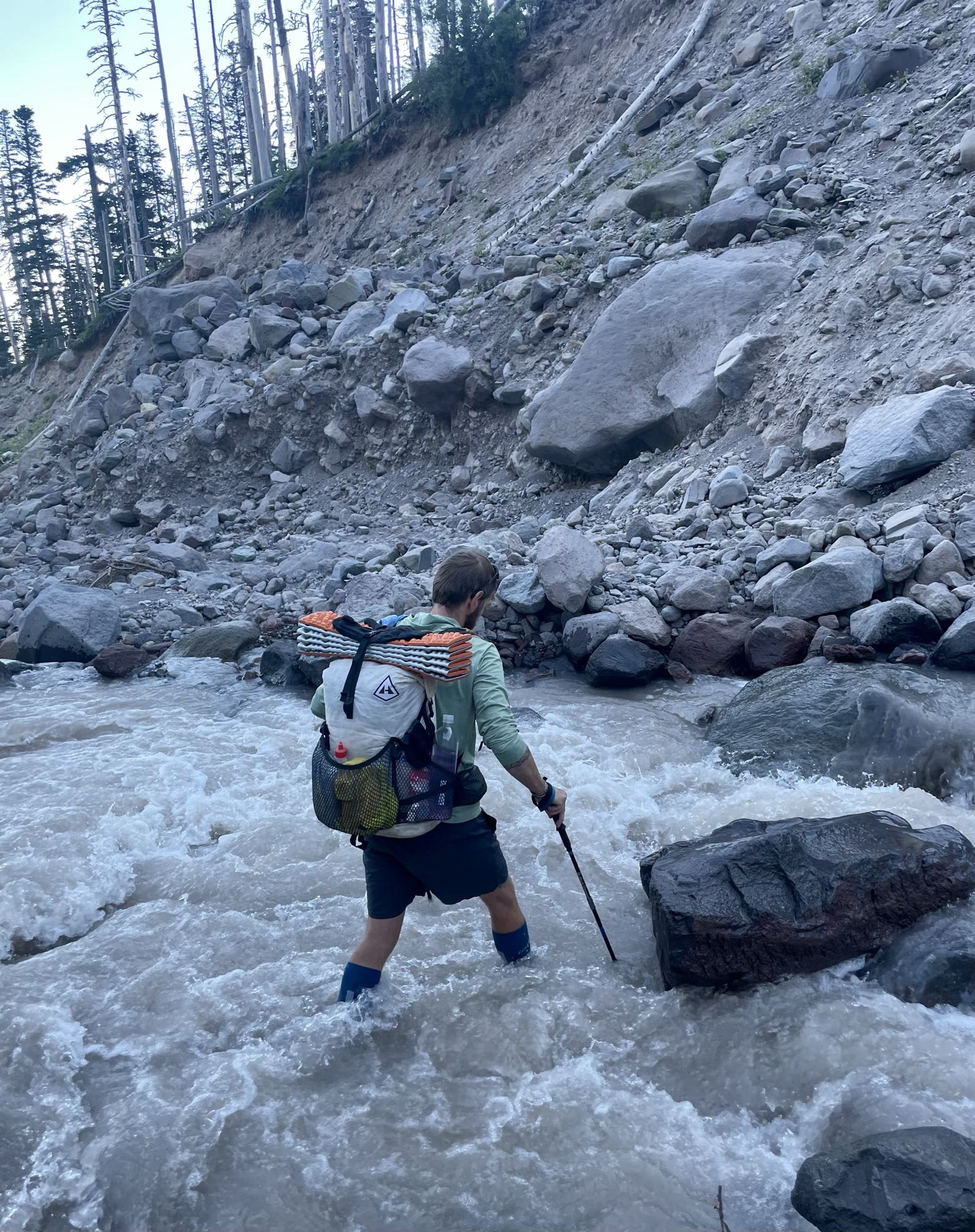
The idyllic alpine meadows of the ski area disappeared as quickly as they'd appeared when the Timberline Trail tilted down towards one final river crossing before at last climbing back to where we'd began. Described as a "violent glacial stream" on a weathered sign nailed to a tree, what struck us most wasn't so much its violence as its vastness. Instead of the steep chasm of the Eliot Branch, the White River was more a massive floodplain with multiple branches of water braiding together. Upstream, the trademark spines of glacial moraine flank each branch all the way up until they disappear beneath what remains of the snow and glaciers above.
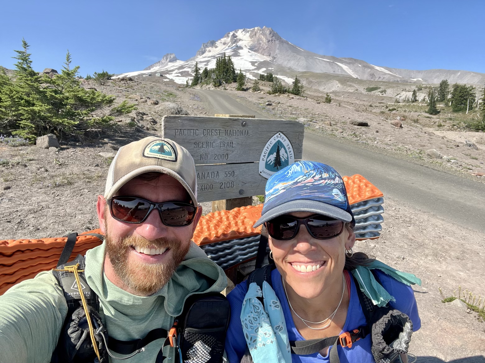
An uneventful final crossing behind us, we took our wet feet and started up the massive sand dune separating us from Timberline Lodge and the completion of the loop, rejoining the Pacific Crest Trail along the way. The ripples of sand beneath each step made certain that only half of the energy we'd expend would be paid towards making uphill progress. The other half would plume into the air behind our feet, like tiny sandstorms. On a breeze-less afternoon and beneath an unsympathetic sun, it was an abject lesson in how to find a happy place inside your own mind.
And somewhere within that slowly cooking head, I found relief thinking back to the last time I climbed this very same stretch of trail. The beautiful light of early morning splashed across the slopes of Mount Hood, shadows pointing the way towards Timberline Lodge and the breakfast buffet that had long occupied the dreams of every Pacific Crest Trail thru-hiker.
This time, there would be no breakfast buffet, no feeding frenzy, no Mountain Mom waiting to join me for the next leg of the journey. There was only a now familiar sign, a volcano view one could never tire of, the promise of a celebratory beer, and a car waiting to bring us to whatever adventure comes next.
Latitude/Longitude: 45.33288,-121.71124